• Antarctica
  • Book Reviews
  • Economics and Taxation
  • Photographs
  • Political Commentary
  • Running
  • Science
  • Short Stories
  • Travel
  • About Richard Watson

Richard Watson

~ Commentary

Richard Watson

Category Archives: Antarctica

All that Glitters is not Gold

13 Tuesday Dec 2016

Posted by Richard Watson in Antarctica

≈ 2 Comments

Tags

Antarctica

[another from the Antarctic course series]

Three days in an Antarctic blizzard on Mount Erebus with just a sleeping bag was good training for what would follow later in his life. Sir Raymond Edward Priestley was an expedition geologist with both Shackleton and Scott in the Antarctic – first with the Boss on the Nimrod expedition from 1907-1909, and then with Scott on the Terra Nova expedition from 1910-1913.

7-6_after_six_men_on_ice

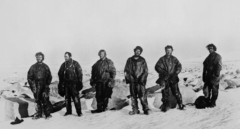
The Northern Party after their long winter in the ice cave From left: Dickason, Campbell, Abbott, Priestley, Levick and Browning.

Although not particularly distinguished academically, Shackleton related that he choose the 20-year old Priestley for Nimrod because “…I can manage that fellow.” That, and Priestley had the correct answer to Shackleton’s question “would you know gold if you saw it?” The Boss always had an eye on the expedition finances. The interview with Shackleton had been arranged by Priestley’s brother. Priestley was in his second year at University College, Bristol, when his brother inquired whether he had an interest in Antarctica. “I’d do anywhere to get out of this damned place.”

There is no great geologic discovery that can be attributed directly to Priestley. From his attitude at Bristol, one would not expect much in the way of original science. Admittedly, he was “…not so hot in school.” And yet…His geology schooling would be in the field among the outcrops, rocks and glaciers of Antarctica. Strictly hands-on lithology. Edgeworth David would be his tutor.

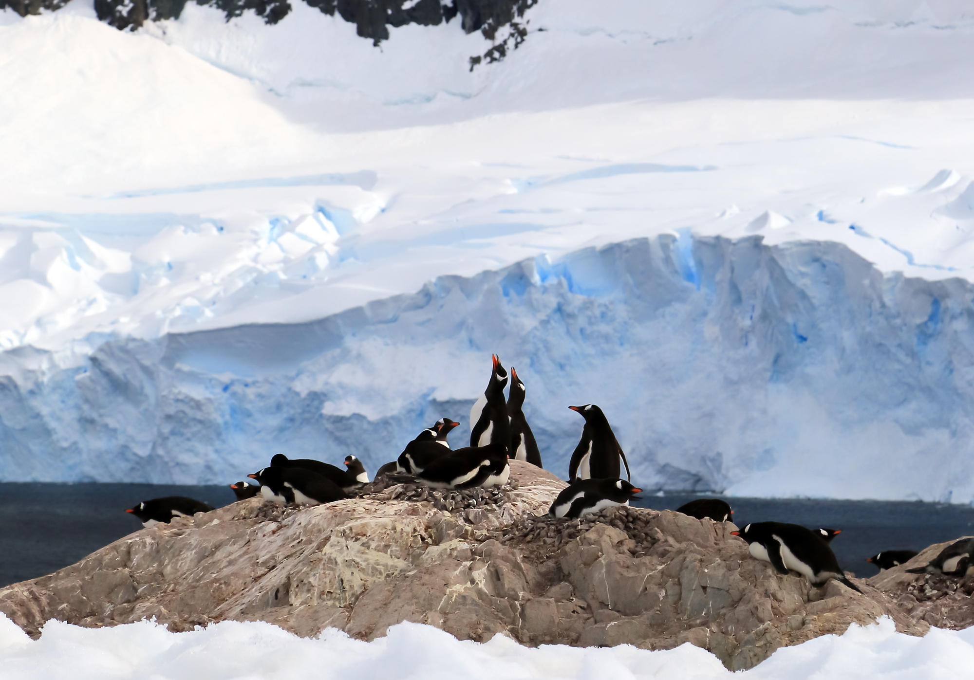
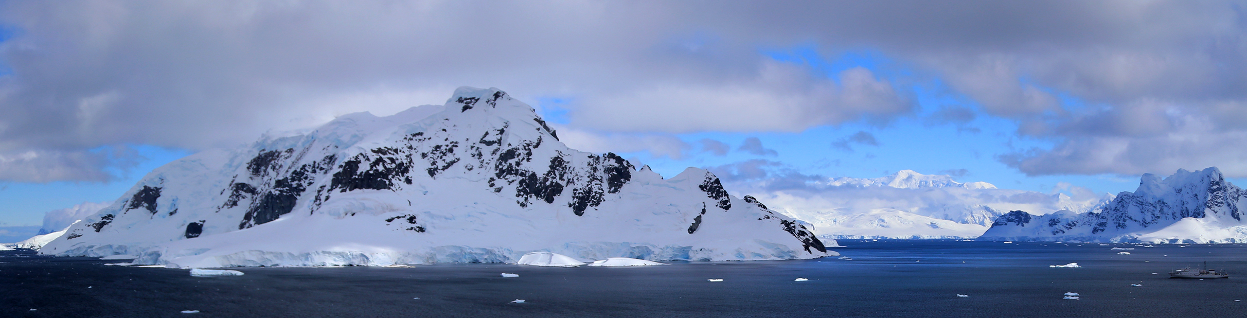
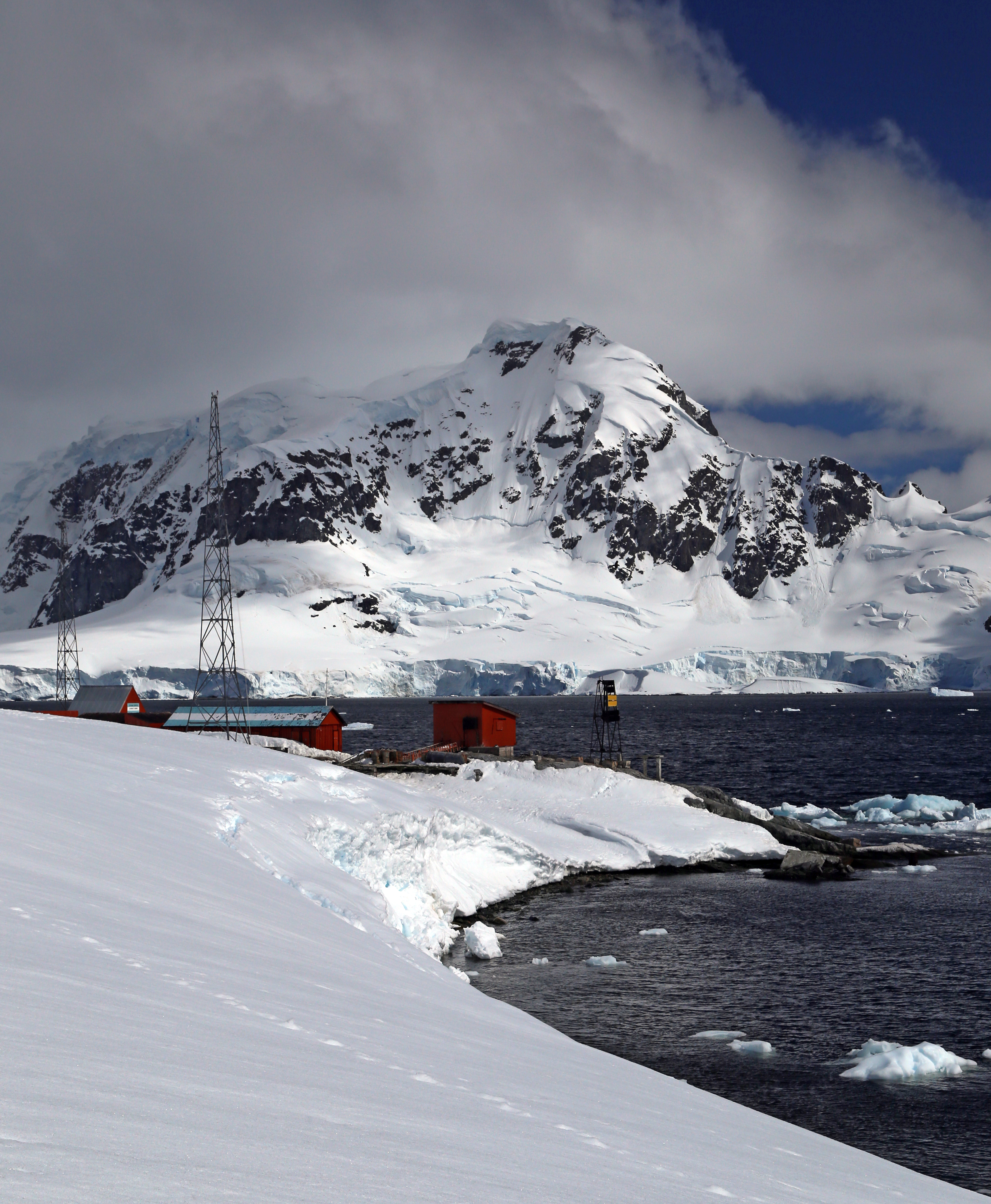
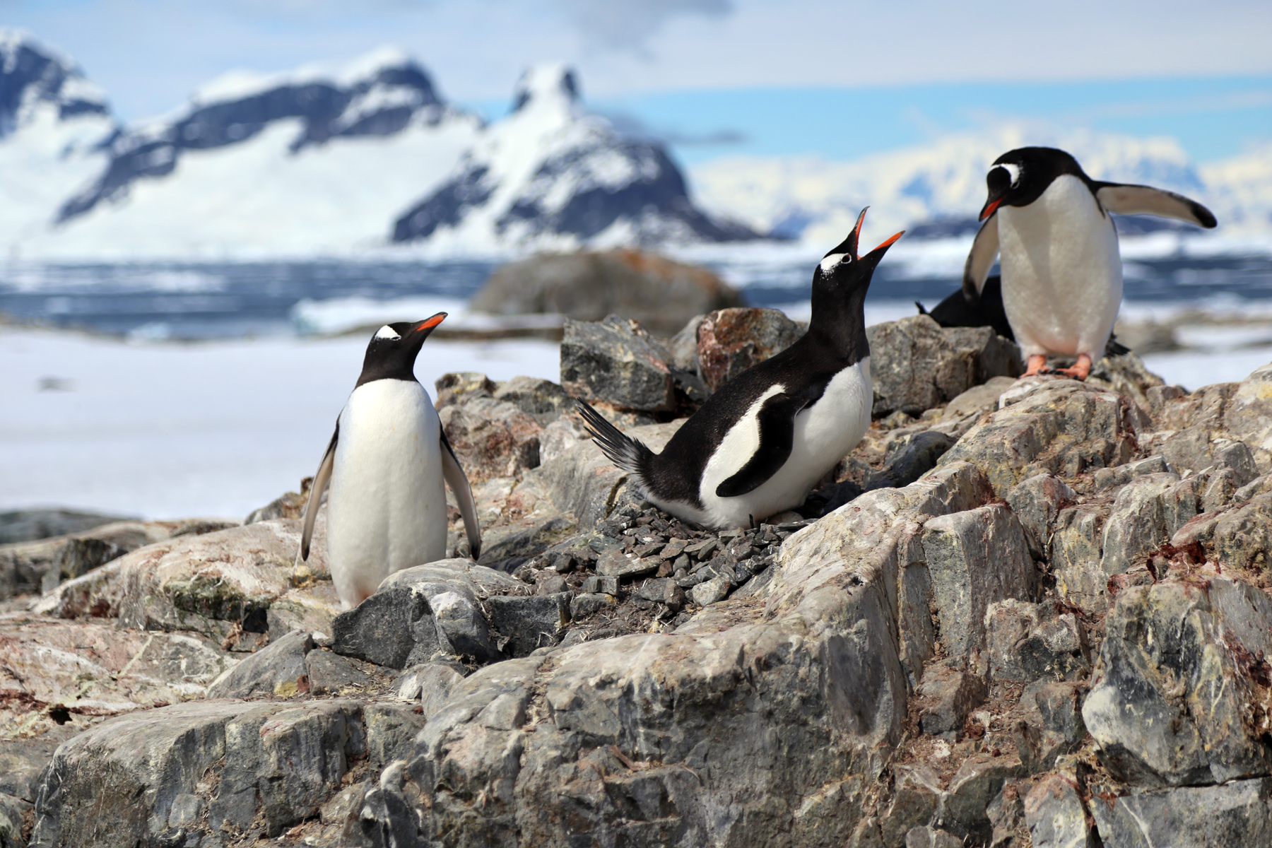
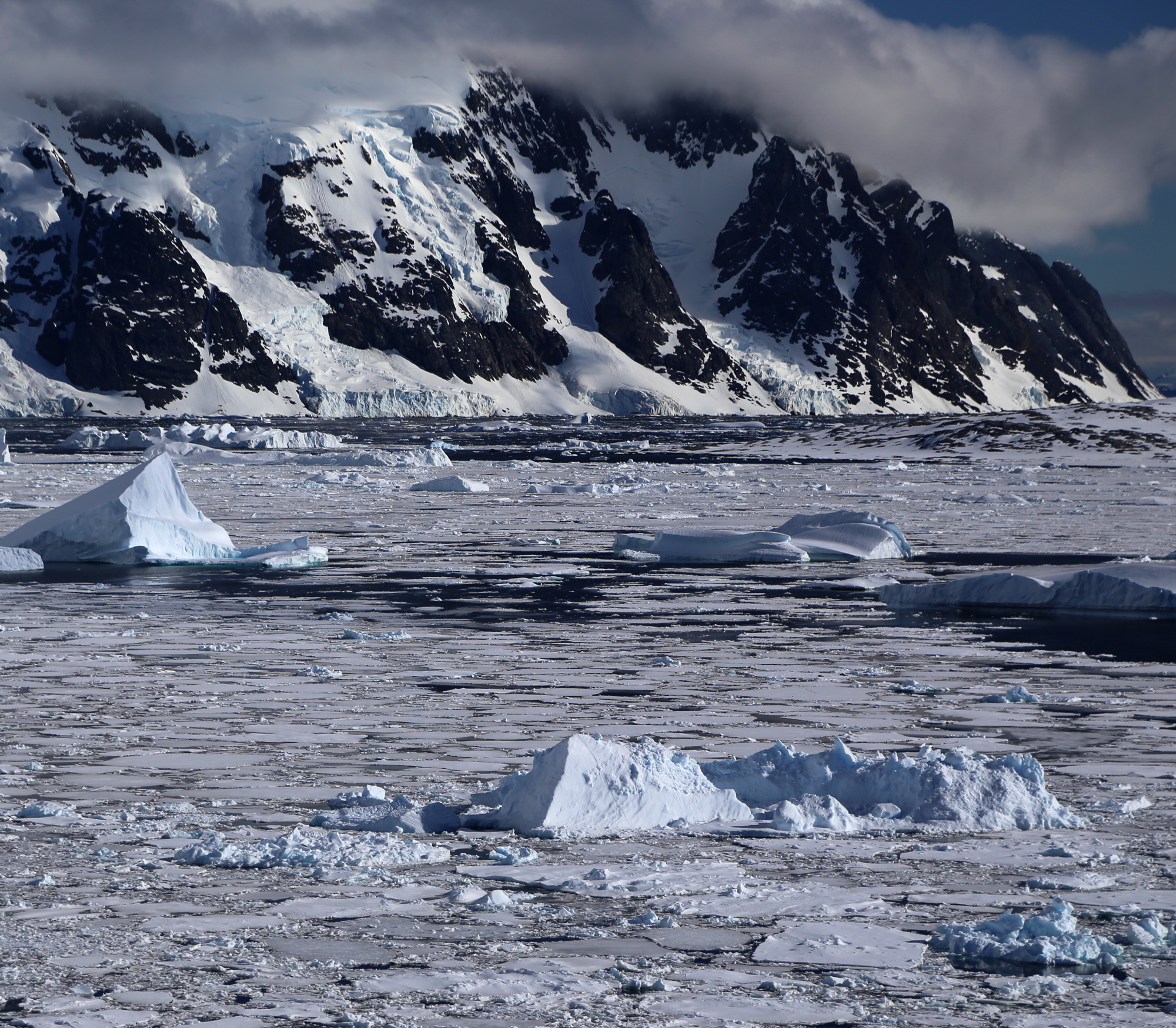
In science, one stands on the shoulders of giants to see a little bit further. Such is the nature of Priestley’s contribution to the science of geology. From an inauspicious beginning, he would add to the geological survey of the Ferrar Glacier and further the understanding of the geology of Southern Victoria Land by publishing a monograph with David (Antarctic Horst of South Victoria Land). During sledging on Mount Erebus, he identified raised beaches and observed eruptions. It was while on Erebus that Priestley survived one of many blizzards, in this case, with just his sleeping bag. The full geological results of the work from the Nimrod expedition would be published with David in The Heart of the Antarctic.

erebus-historic-camp-modern-old

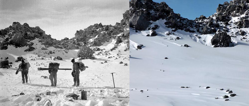
Camp on Mount Erebus. 1912 and 2012. Credit: Picture Library, Scott Polar Research Institute, University of Cambridge.

But it was his experience wintering in an ice cave with the Northern Party of Scott’s Terra Nova expedition on Inexpressible Island, in what Vivian Fuchs called “a story of human endurance which has rarely been equaled,” that puts Priestley in the same league as Amundsen, Scott and Shackleton. Cherry-Garrard would add his own wisdom to Priestley’s tale in a summation that is concise and packed with relevance to a twenty-first century audience. “The necessaries of civilization were luxuries to us: and as Priestley found under circumstances to which our life at Hut Point was a Sunday School treat, the luxuries of civilization satisfy only those wants which they themselves create.”

Priestley published an account of the Northen Party’s expedition in Antarctic Adventure: Scott’s Northern Party. At times, his writing is the equal of Scott or Cherry-Garrard:

“I think the coldest thing I ever remember to have seen was the aurora which met our eyes when we tumbled out of our tent that morning to fetch the primus and cooker. It looked absolutely the essence of frigidity, and I know well enough now what I shall mean in the future when I speak of a cold light. A single arch of brilliant greenish-grey, like the curved blade of an immense scimitar flashing in moonlight, stretched across the sky from south to north.”

igloo

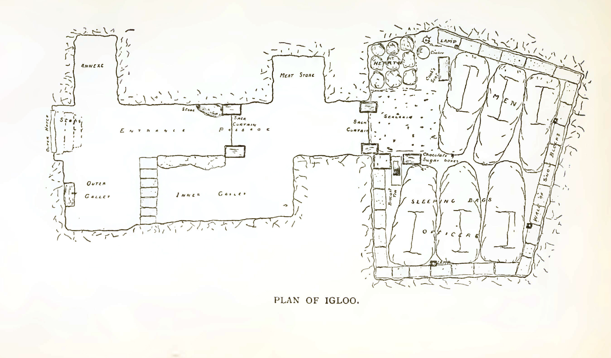
Plan of the Snow Cave – Priestley.

After his dark Antarctic winters, “…the Winter of the world with perishing great darkness” (Wilfred Owen) closed in on Priestley as the lights went out in Europe. Like many men from Shackelton’s Endurance expedition, Priestley served in World War One. He received the Military Cross for his involvement in taking the Riqueval Bridge on the Hindenburg Line (a German defensive position) in Northern France in 1918. On one-day, nearly one-million shells were fired during a twenty-four hour period. To Priestley, it must have seemed like the katabatic winds of Antarctica were shredding his tent once more, and that perhaps he was back on Erebus with just a sleeping bag.

After the war, he helped create the Scott Polar Research Institute in 1920, and followed that with the distinguished academic career he initially abandoned when he made his “Easting down” with Shackleton in 1907.

Priestley meet Roald Amundsen onboard the Fram in January 1911 when Terra Nova sailed into the Bay of Whales. Thus, he speaks with some authority when he compares the three great explorers of the Heroic age in what is perhaps the best analysis ever written, made all the more poignant for its brevity. “For scientific discovery, give me Scott; for speed and efficiency of travel, give me Amundsen; but when you are in a hopeless situation, when you are seeing no way out, get down on your knees and pray for Shackleton.”

Though his science was not necessarily geologic gold, he can most certainly be considered one of the geologic glitterati.

antarcticadventu00prie_0009

The Really Deep Challenge

13 Tuesday Dec 2016

Posted by Richard Watson in Antarctica, Climate Change

≈ Leave a comment

Tags

Antarctica, Climate Change

[the following is from a paper I wrote for an Antarctic course last spring]

“Airborne platforms…are ideal for ice-shelf cavity exploration due to their…operational insensitivity to crevasses (compared to surface-based data acquisition) …” (Southern Ocean Observing System). This is the scientific way of explaining that whereas people can fall into crevasses, airplanes generally do not. The challenge for scientists has always been one of translation. How to take meaning-laden, complex words and concepts and, without losing the gist, set them in a context for public consumption and discussion. Newton had it easy. Although the inspiration was brilliant, his expository was simple. The apple fell from the tree.

tae

The Crossing of Antartica (Thames & Hudson)/George Lowe, Huw Lewis Jones, the 1957/58 Commonwealth Trans-Antarctic Expedition.

Modern scientists have a harder challenge. Not only is the science more complex and difficult to understand, but the reality television mentality of many politicians and policy makers has promoted a culture that embraces ignorance. Witness Anderson Cooper’s comment to Donald Trump at a recent “debate” – “that’s the argument of a five year-old.” Such is the milieu in which the Challenge is set.

New Zealand is getting it right with its Deep South Challenge. Accepting that climate changes, the idea is to “adapt, manage risk and thrive in a changing climate.” To do so, and arrive at correct and economically viable decisions, a multi-disciplinary approach involving a positive feedback loop consisting of the public, educators, scientists and policy makers helps inform the science. For instance, what do civil engineers and architects need to know about extreme weather events when planning infrastructure; how do farmers manage crops in the face of more frequent droughts; how should tax and insurance policies be designed to benefit those communities most at risk to sea level rise so that the larger public good is not abused? This is the ground-truthing of public policy – using societal concerns and issues to prove the value of the science.

The Deep South Challenge has developed various engagement strategies to ensure that the science done in the Antarctic “…remains focused on and directed by societal needs.” Through lectures, seminars, briefing sessions and technical workshops, the Challenge responds “…to the most important national-scale issues.” Open and continuous communication is achieved by the use of online media, science festivals and public workshops among other tools. In this way, scientific priorities and research programs are established which lead back to the ground, or ice, in Antarctica.

antarctic_comp-0500

Antarctic sea ice. NASA.

Data and observations gathered on and around the continent help in the development of an earth system model which allows better management of climate risks. Climate observations in Antarctica help improve atmospheric models which in turn provide more reliable and precise weather forecasting. This allows the constituents of the Challenge to more effectively determine and plan for the impact of climate change on the economy and infrastructure. For instance, infrastructure decisions are improved by adding the stressors and risks associated with climate change to existing tectonic based models. It is well enough to understand what happens when the earth shakes, but you also need to know what energetic storms laden with heavy rain, wind, snowfall and resultant flooding can do to the roads.

Extreme weather events can be seen as beginning in Antarctica. In situ work on ice-shelf cavities, as an example, feed directly back into weather models and test the validity and predictive value of the computer programs. Ice sheets lose mass at their boundaries which are generally where ice meets water along the leading edge and underneath the sheet itself – the cavity. As warm water enters the cavity, the sheets thin and are more vulnerable to fracture. But unlike a dental cavity, you can’t X-ray an ice sheet cavity. Gravitational measurements taken from aircraft, and ship based radio echo sounding and magnetic data help to map the relevant geography. This complex interaction of water and ice is the beginning of a deep river that cascades off the continental shelf and drives global ocean currents. So it is important to understand this interaction and to have models that predict what is observed on the ice.

Models must also explain the apparent inconsistencies that are so often picked up and paraded in public by politicians and talk show hosts. If global warming exists, why has the extent of winter sea ice around Antarctica been increasing? Recent extreme winters on the east coast of the United States have been used by politicians as evidence that global warming does not exist, and a significant portion of the population follows along.

There was a brief time when science captured the imagination of the world. From that moment when man walked on the moon, an entire generation was motivated to achieve the astounding. The benefits of the science, research and education that flowed from the Apollo missions can still be seen today in medicine, communications and computer and earth sciences. Because of its global impact, the next wave of imagination can be stimulated by Antarctic science.

watercirculationantarctica_zpsf3bce891

Water circulation – Antarctica.

Neko Harbour

27 Saturday Dec 2014

Posted by Richard Watson in Antarctica, Travel

≈ 2 Comments

Tags

Antarctia Peninsula, Neko Harbour

Change occurs slowly in Antarctica. Even those dramatic and astounding moments when it seems the very earth is breaking apart are insignificant when the scale of the continent is considered. And yet locked in Antarctic ice are tales of a landscape beset by cataclysms and ravaged by the metamorphosis of extreme time.

The view at Neko Harbour.

The view at Neko Harbour.

We are in Neko Harbour, and I am watching a mere whisper of Antarctica’s story – an inconsequential few seconds that, when added to others, result in incomprehensible change on a clock that has been ticking for billions of years. But I feel as if I am witnessing the birth of the oceans.

One hundred million years ago, I would be standing in a cool forest not unlike those that exist in present day South America (Frozen in Time, Prehistoric Life in Antarctica). Petrified tree trunks and carbonized leafs found on Seymour Island tell this chapter of Antarctica. Even before this, dinosaur fossils found in the Antarctic are prologue to the breakup of Gondwana, the great southern supercontinent. There are rocks in Antarctica that have been dated at 3.8 billion years old (Antarctic Peninsula, A Visitor’s Guide).

Skuas heading up slope.

Skuas heading up slope.

Looking across Neko Harbour in the present day, two glaciers silently meet at the water’s edge; the scene appears as frozen in time as the ice that makes up these unlikely rivers. Any movement is imperceptible to my eye, yet great buckles in their otherwise smooth surface speak of the tortured ground over which these glaciers flow. They can advance up to one-hundred meters a day, and to a depth of sixty meters, their ice is brittle and fractures, creating seemingly bottomless crevasses. Below this depth, ice flows over and around obstacles just like a pliable plastic (Antarctica, Global Science from a Frozen Continent).

With an average annual precipitation of just thirteen centimeters per year, Antarctic is a desert. Like any desert, there is much that is hidden, waiting to be discovered. But in this case, it is hidden by ice.

One sits down on a desert sand dune, sees nothing, hears nothing. Yet through the silence something throbs, and gleams… – Antoine de Saint-Exupery

The topography of the ground beneath the ice can usually be discerned by what happens as ice moves – except when the depth of that ice is measured in miles. Over forty million years, the East Antarctic ice sheet has accumulated ice that is, in places, three miles thick. There are entire mountain ranges, replete with 8,000 foot peaks, which lie beneath endlessly flat ice fields.

IMG_1080-2

Poised to calve icebergs.

Since the average age of ice in East Antarctica is just 125,000 years (Earth, Portrait of a Planet), over time, a lot of ice has been dumped into the Southern Ocean. The usual depository method is via glacier or ice sheet. There are moments when city-sized ice bergs splinter into the sea. There are also moments when ice is blasted into the atmosphere.

There is a sub-glacial volcano in the Hudson Mountains (another mostly buried mountain range) near the Pine Island Glacier. This glacier drains about ten-percent of the West Antarctic Ice Sheet. Steam has been noticed to vent through cracks in the ice. Ice cores drilled in the area by scientists from the British Antarctic Survey show that a significant eruption occurred here some 2,200 years ago which blasted ash seven miles high. Lava still flows under the ice. In 2013, an iceberg (named B31) the size of Singapore broke off the glacier. It is now drifting into the Southern Ocean.

Calving of ice causes consternation among penguins.

Calving of ice causes consternation among penguins.

The glaciers I am watching at Neko Harbour generate bergs that are mere ice cubs compared to B31. Nevertheless, they form an impressive and impassible wall two miles wide. A moment later, two cannon shots echo across the Bay, and newly born icebergs tumble into the water. Near the shore, this poses a minor inconvenience for some Gentoo penguins as waves wash over the cobble stone beach. The Ioffe repositions herself as an older berg moves threateningly towards her.

Dodging ice bergs in Andvord Bay.

Dodging ice bergs in Andvord Bay.

Antarctic ice is critically important to human life and not just because of what it can do to sea levels. The oceans are the Earth’s most important carbon sink, and Antarctica helps drive the process. Since carbon dioxide dissolves in water, it is removed from the atmosphere by the oceans. When winter comes to Antarctica, the continent doubles in size as water freezes. The saline content of the unfrozen, carbon laden water increases, making it heavier and taking it to the bottom of the Southern Ocean. In the spring, when the ice thaws, this global pump begins again.

O! how shall summer’s honey breath hold out,

Against the wrackful siege of battering days,

When rocks impregnable are not so stout,

Nor gates of steel so strong but Time decays?

– Shakespeare, Sonnet 65

See Part VI – Wilhemina Bay

Antarctic Links

Wilhelmina Bay

16 Sunday Nov 2014

Posted by Richard Watson in Antarctica, Travel

≈ 1 Comment

Tags

Antarctia Peninsula, Antarctica, Wilhelmina Bay

There are few things that take my breath away in this world. Such rare and precious moments of utter astonishment and joy are the highlights of life. As singular events, they may be different for each person. Yet that feeling in your heart, perhaps an involuntary shudder in your body, a sharp in-breath, a gasp and an electrifying buzz heightening all your senses, will be familiar.

For me, I can list the following events: watching the sunrise warm the sands of the Namibian desert from the top of a one-thousand foot dune; seeing elephants appear like apparitions right out of the forest while on a Kenyan game walk; my first sight of the Antarctic Peninsula; watching Pete Townshend slash away at his guitar; that still, silent stare of a deer I encounter while on a quiet trail run; the incomprehensible number of stars you can see in a truly dark sky; astronauts walking on the Moon; and, anytime I see a whale in its natural habitat.

Whilemina-4

John Rodsted scouting for whales in Wilhelmina Bay.

The Southern Ocean is a special place for whales, and Wilhelmina Bay is a favorite gathering spot on the Antarctic Peninsula. We will go looking for them today, but that will be in the afternoon. This morning’s adventure takes place on Orne Island.

I am ready to go and have slept well during the night. Debbie spent the evening sleeping under the pink twilight on Ronge Island, choosing the camping option. Whereas I needed some solid slumber and chose the gentle rocking motion of the ship. Debbie appears around six in the morning, glowing in the warm light shining through the softly opened door. The cabin is dark, but great contentment is expressed in her face, and I realize the experience far out-shined any lack of sleep. We swap places for now, and I head off at the first announcement of breakfast.

Whilhemina-2

In flight.

As we zodiac towards Orne, some detours are made to investigate icebergs which catch our fancy. There is fleeting magic in their shapes and colorful blue tints. Next week, they will look different. Not one of them is the same.

Icebergs are tersely classified by height and shape, the shorter ones having the most imaginative names such as growler and bergy bits – those which barely show at the water’s surface. The largest icebergs are called, well…just very large. Most striking are the blue bergs. A deeply blue berg has been some time in the making as most of the air bubbles have been compressed out of the ice. Blue light cannot penetrate their denseness. Technically, the darker color results because the blue wavelengths are not absorbed by ice that is free of trapped air. These higher frequency wavelengths are therefore scattered back into your eyes which perceive a deeply soothing shade of blue (Glaciers & Glaciation).

Whilemina-1

Bigger than a bergy bit.

On arrival at Orne, Chad is at the landing site and gives us the lay of the land. He sketches out the safe hiking boundaries and reports that the toboggan run is open near the peak of the island. From my vantage point halfway up the slope, it looks like you can slide all the way into the Errera Channel. This is also chinstrap penguin country.

89-chinstrap

A chinstrap on Orne Island.

On return to the Ioffe, I rejoin Debbie. After lunch we embark in the zodiac and begin looking for whales in Wilhelmina Bay. Katabatic winds can slam down from seven-thousand feet above the bay and whip the water into a frenzy. But today it is merely overcast. Mette is piloting, and binoculars are scanning the horizon. We stop to admire some Antarctic Terns as they gracefully alight on top of an iceberg.

Off to starboard, we spot the ephemeral spout that is the sign post of a whale exhaling upon its return to the surface, warm breath condensing into a mist when it hits the cold Antarctic air. If you are close enough, the fishy smell of so many krill informs as to a whale’s principal diet. Whales like to eat krill. If you are a blue whale, during the Antarctic summer, you might graze on four tons of krill a day (Antarctica, Global Science from a Frozen Continent).

93-hiking-Orne

Hiking to the landing site on Orne Island.

Such creatures are remarkably graceful. Gliding through waters, grouped in pairs in an elegant, almost silent dance, there is a moment before they dive deep when their backs arch and their magnificent flukes rise out of the water. There is that gasp that takes your breath away. Each fluke is like a finger print, and individual whales can be identified by their unique pattern.

In a similar manner, the dorsal fin of an orca can be used for identification. It is now known that some whales live to be over one-hundred years. The prosaically named J2 was seen last May off the coast of British Columbia and is believed to be 103 years old. This grandmother was still swimming with her pod at that time.

Seeing whales unhindered in these fantastic waters, it is easy to forget that during the years of commercial slaughter, perhaps 1.3 million whales were killed in the Southern Ocean. Even though whales have had some 40-years of protection in these waters, blue whale populations are still estimated at only 15% of the numbers that existed before humans came to Antarctica.

These figures do not include the genocide that occurred in the Arctic. Beginning in the early 1600s from Svalbard to the Greenland Sea, then on to Baffin Bay and finally the waters of the Southern Ocean around Antarctica, these gentle mammals were almost brought to extinction in the 20th century.

Barry Lopez talks about “the carnage of wealth” when describing the devastation caused by the whaling trade. The skin of a whale “…is so sensitive to touch that at a bird’s footfall a whale asleep at the surface will start wildly. The fiery pain of a harpoon strike can hardly be imagined.”

And now, whales are again threatened by countries that harvest krill. Should this important food source fail, further stress would be added to the survival of whale populations. Countries such as Japan and the United States have even gone so far as to try and enlist the help of the U.S. Internal Revenue Service in an attempt to silence the important work done by nonprofit groups such as Sea Shepherd, which call attention to these issues. Thanks to Wikileaks, we know that the U.S. representative to the International Whaling Commission conspired with the Japanese in 2009 to attempt the revocation of Sea Shepherd’s tax exempt status.

91-chinstrap

A lone chinstrap climbs a slope on Orne Island.

What a grim world it would be if whales were to become extinct. If those stars I mentioned at the beginning of this piece are not to weep, and are to remain bright, we must remember that it is important to walk softly on the Earth, to respect and cherish all life, and to remember that we are stewards of the planet.

One Ocean Expeditions mentioned that after taking this voyage, we would become ambassadors for Antarctica. Perhaps in going to Antarctica, we also become ambassadors for the planet.

See Part V, Almirante Brown

See Part VII, Neko Harbour

Antarctic Links

“The history of the human race is a continual struggle from darkness into light. It is, therefore, to no purpose to discuss the use of knowledge; man wants to know, and when he ceases to do so, is no longer a man.” – Fridtjof Nansen

Almirante Brown

04 Saturday Oct 2014

Posted by Richard Watson in Antarctica, Travel

≈ 2 Comments

Tags

Almirante Brown, Antarctia Peninsula, Antarctica

“From here you can walk to the South Pole.” Although it is perhaps 1,700 miles as the skua files. Noah Strycker, author, ornithologist and Associate Editor of Birding magazine, who once spent three months with 300,000 penguins at Cape Crozier, is showing us the sights. We are perched with Noah on a ridge some two-hundred feet above an infrequently used Argentine base at Paradise Bay.

Looking to the west and dominating the foreground, clouds blanket Bryde Island. Its humpbacked peaks seem poised to dive into the sea. Lemaire Island is to the right, and the Ioffe is docked in the shadows of clouds over Paradise Bay. Wiencke Island is visible beyond the strait – its nearly five-thousand foot peak stands bright and clear above a strata of clouds. The rocks speak of long extinct volcanoes.

Interspersed with the geography tour, Noah has been delightfully regaling us with bird stories. In his latest book, The Thing with Feathers, The Surprising Lives of Birds and What They Reveal About Being Human, he writes that “penguins untied my shoelaces, hesitatingly preened the sides of my sleek pants, and fell in line behind me in a drawn-out game of follow-the leader.” It is impossible to watch a penguin and feel anything but complete joy.

Brown-1

View of Paradise Bay from above Almirante Brown Station.

But the charred edges of the station below tell a story that is other than joyful. The name of the Argentine base is Almirante Brown Station. The original base was constructed in 1951 and burned in 1984, allegedly by a member of the scientific staff who did not wish to “winter over.” From the very first expedition to spend an entire winter in Antarctica, the long Antarctic night has had a reputation of pulling minds into dark corners.

When Adrien de Gerlache’s Belgica stuck fast in the ice in 1898, the bosun refused to work, fearing that other crew members were plotting to kill him. He was like a “wild creature” in a cage. The expedition’s doctor wrote that “…we are at this moment as tired of each other’s company as we are of the cold monotony of the black night…”

Brown-2

Walking towards the landing site.

During Sir Ranulph Fiennes’ 1980 crossing of the Antarctic continent, base commander Ginnie Fiennes “…heard babies crying in the darkness and someone whispering incoherently from close behind her.” She told her husband “…there’s something there…” when of course there was not (The Third Man Factor, John Geiger).

The Boss himself (Ernest Shackelton) spoke of a presence while crossing South Georgia with Worsley and Crean – “…during that long and racking march of thirty-six hours over the unnamed mountains and glaciers of South Georgia it seemed to me often that we were four, not three.” Shackelton wrote about the experience that “…there is much that can never be told…we had pierced the veneer of outside things.”

This very same glittering, blue and white landscape that is now before me does not reconcile with such ancient impulses and fears. And yet, my sense is that these experiences are part of the draw of this cruelly beautiful landscape. It is unsettling to be stripped of the familiar references and distractions of civilization – to have no compass.

Brown-3

There is a scarcity of landing sites. Those that are safe, cling to the shore with a narrow margin.

I find these feelings accompany me at night when I am alone in the desert, since our overly bright cities shield us from the empty immensity of the universe. I lose my bearing and become lost in the stars. Enveloped by blackness so dark, I become fearful of what I might see should a light suddenly illuminate the unknown. And when the full moon is at my back casting shadows, its seemingly imperceptible gravitation tug is like an unrelenting and unshakeable presence just out of sight.

Antarctica is technically a desert. So it is without surprise that I revisit these most wondrous and strange friends here. Some people uncover great religions in deserts. I discover little bits of myself in their vast emptiness. I begin to appreciate my imperfections, and my demons soften when light shines through the cracks. That is of course, the purpose of cracks and of perhaps Antarctica – to let the daylight in upon darkness (Leonard Cohen) – whether those cracks be personal, or those that threaten the very survival of humans on this planet.

The greatest obstacle to living is expectancy, which hangs upon tomorrow and loses today… The whole future lies in uncertainty: live immediately.

– Lucius Seneca (ca. 4 BCE – 65 CE)

Part IV – Lemaire Channel

Antarctic Links

See Part VI – Wilhemina Bay

Antarctic Links

10 Wednesday Sep 2014

Posted by Richard Watson in Antarctica

≈ 4 Comments

Tags

Antarctia Peninsula, Antarctic Websites, Antarctica

The following is a list of various websites of interest concerning Antarctica. It is meant to accompany the chronicles of our Antarctic Peninsula trip in 2013 and serve as a reference source for additional information.

Part I, The Antarctic Peninsula

Part II, Ushuaia

Part III, The Drake Passage

Part IV, Lemaire Channel

Part V, Almirante Brown

Part VI, Wilhelmina Bay

Part VII, Neko Harbour

Part VIII, Deception Island (coming soon)

Part IX, Rounding the Horn (coming soon)

Part X, Return to Buenos Aires (coming soon)

42-lemaire

Morning in the Lemaire Channel.

Amundsen-Scott South Pole Station. A nice blog on the happenings at the South Pole.

Antarctic Fox. An often humorous account of a trip to the Antarctic Peninsula.

The Antarctic Heritage Trust. The people who conserve expedition bases left by explorers.

The Antarctic Heritage Trust. This is the UK version with includes the lively Port Lockroy blog.

The Antarctican Society. A U.S. based non-profit devoted to educational issues.

Australia’s center of Antarctic and Southern Ocean climate change research which studies climate change impacts in Australia and the Pacific.

The Antarctic Sun. News from the United States Antarctic Program.

Australia’s Antarctic Division.

Antarctica New Zealand. Scott Base – the other base on Ross Island.

The British Antarctic Survey. Maps, books and more.

Byrd Polar Research Center. Looking at what happens when things get cold.

Cool Antarctica. A nice discussion on extreme weather clothing.

Council of Managers of National Antarctic Programs. Coordinating scientific research on the continent.

Field Manual for the United States Antarctic Program. In case you would like to learn how to build a snow shelter.

Gateway Antarctica. New Zealand’s center for study and research.

International Association of Antarctic Tour Operators. IAATO is the rule setting body for responsible tourism.

Possible landing sites on the Antarctic Peninsula.

Mariners Weather Log. Though not specifically about Antarctica – news and information about worldwide weather events and phenomena.

National Science Foundation Division of Polar Programs.

New Zealand Cluster Munition Coalition. Important work done by Antarctic guides in between polar seasons.

Noah Stryker. Birder extraordinaire and author who once spent three months with three-hundred thousand penguins at Cape Crozier.

The Oates Collection. All about the man who went outside and has been some time.

OneOcean Expeditions. The people to see about visiting Antarctica.

Operation Ice Bridge. Building a record of the Earth’s changing ice.

Antarctic Place Names. Provides a useful interactive map.

The Polar Conservation Organization. Dedicated to a sustainable future.

The Scientific Committee on Antarctic Research. All the latest cutting edge stuff.

Scott Polar Research Institute. Research in both the north and south.

Sea Sheppard. Though not an Antarctic site, this group does important work addressing the destruction of habitat and slaughter of wildlife in the the world’s oceans.

South Georgia Heritage Trust.

South Pole. Presenting a history of Antarctic exploration.

From NASA’s Earth Observatory – a discussion of the West Antarctic ice sheet.

Brown-1

Bryde Island in Paradise Bay.

Lemaire Channel

17 Tuesday Jun 2014

Posted by Richard Watson in Antarctica, Travel

≈ 3 Comments

Tags

Antarctia Peninsula, Booth Island, Penola Strait, Petermann Island, Port Charcot

“Maybe we have lived only to be here now.” Barry Lopez, Arctic Dreams

41-lemaire

Morning in the Lemaire Channel.

There is a soft, audible in-breath on the ship’s public address speakers. Like someone is emerging from a deep, meditative trance. Relaxed but confident.

“Good morning. It is now 6 AM, and if you are not out on deck now, you should be. Welcome to Antarctica and the Lemaire Channel. Breakfast will be served in the dinning room at 7:30 AM.”

42-lemaire

Lemaire Channel.

Thus lulled awake by Chad, we hurriedly dress in layers, head caps, scarves and gloves, grab cameras and binoculars and dash to the forward observation deck where “the air bites shrewdly.” Although it is probably no colder than the mid-20s (Fahrenheit), it is not the invigorating chill that causes me to gasp. The palate of colors before our eyes reveals every shade of blue, with contrasting blacks and blinding whites reflecting a sun that can burn your skin in five minutes. Small bergs with darkly compressed blues appear inverted and reflected in water still as a mirror and obsidian black. Although the ship is moving, there is a hush in the air that complements the incomparable scene before us. Occasionally, the crisp brush of ice against the hull brings me out of my day dream. Debbie has a wide contented smile on her face.

Behind us, at the northern entrance of the Channel, the Una Peaks stand 2,451 feet above glassy water, clouds trailing away from the twin summits like a veil. The deeply black rocks of these sentinels are what is left of extinct volcanos formed by a subduction zone which began throwing lava and volcanic ash into the air some 183 million years ago. The mountains which line the Channel were once connected to the Andes in South America. Further north in the Bransfield Strait, one plate is still slipping under another. Tectonic activity along this Peninsula can confuse the local magnetic fields. Beyond the southern exit of the Channel, in the Penola Strait, are humpback and minke whales. But it is time for breakfast and our first expedition.

60-next-destination

Una Peaks. Later in the day.

At the morning briefing, Chad lays out the activities for the day. The ice has blocked the passage to the Ukrainian station at Verdnasky, which boasts the southern most public bar on the planet. So we will be unable to see the famous wall that holds a collection of bras donated by visitors. Ukraine purchased the station from the British for the sum of one-pound in 1996. It was here in 1985, that scientists from the British Antarctic Survey realized the ozone values in these rarified skies had been decreasing since the 1970s.

Chad explains that the first excursion of the day will be to Circumcision Bay on Petermann Island (so named because it was discovered on the day of the Feast of the Circumcision, Forgotten Footprints). Then Michele Grant announces that the kayakers will meet in the mud room and be offloaded into the zodiacs before the gangway is open to the rest of the passengers. This is our cue to finish breakfast, grab our gear, and make for the mud room.

53-photographing-penguins

Photographing penguins on Petermann Island.

One of the queries on the pre-trip questionnaire asked whether we had ever “wet exited” a kayak. That is, tipped it over and exited while under water. Since this seemed like something to try first in warmer waters, we took lessons at Point Reyes on Tomales Bay some months before.

Our instructor at Blue Waters Kayaking taught us how far we could lean the kayak to the left or right. This was a prelude to actually rolling over and wet exiting which was planned for later in the day. The first lesson was about getting a sense of balance.

I was somewhat timid at first, so she appealed to my adventurous side (remember that I am an accountant – I don’t have adventurous sides) and encouraged me to lean to the left just a bit more.

“You mean like this?”

I was upside down and under water in an instant, trying to recall the move I was supposed to make that would pop me out of the cockpit and back to the surface. Remembering her instructions, I reached for the tab at the front of the skirt and yanked hard. Buoyancy did the rest, and I was breathing fresh air again.

“Well, it seems like it’s time to learn the T-rescue,” was our instructor’s comment…with a big grin on her face.

Back in the Ioffe’s mud room, we change into our dry suits, place cameras in dry bags, and make our way to the starboard gangway. Our names and cabin number are checked off, and a moment later we are in the Penola Strait taking our first zodiac ride.

55-glacier

Glacier viewed across the Penola Strait from Petermann Island.

“This cord I am holding will cut the motor if I fall over board.” Sarah Scriver, our driver, is explaining some zodiac safety while we cruise to where the kayaks have been off-loaded (her OneOcean bio states “Sarah has climbed to 6000m in the Andes, lived with a Shuar tribe in the Amazon Rainforest, chased tornadoes in the American Midwest and trekked for days in the remote wilderness of BC, Canada”).

“In case you feel like rescuing me, you’ll need to plug it back in like this to get the outboard working again.” But then, she is so relaxed and sure in her navigation that it is hard to imagine this scenario. Nonetheless, I glance at the plug.

Debbie and I are soon in our tandem and over her left shoulder, some three and one half miles distant, is Mount Scott. It seems all I need to do is reach over her shoulder to touch its summit. I must recalibrate my sense of distance. Without pollutants, dust and water vapor (despite all the water and ice, it is dry), the landscape is deceiving. I must look with new eyes.

44-kayak

View from the back of the Tandem.

Sarah has withdrawn the zodiac to a discrete distance. Close enough to be quickly at hand, but outside of our immediate awareness. Our paddles carve gentle strokes through the water creating the only sound in a vast panorama. There is nothing else I could want at this moment.

“The necessaries of civilization were luxuries to us: and as Priestley found under circumstances compared to which our life at Hut Point was a Sunday School treat, the luxuries of civilization satisfy only those wants which they themselves create.” Apsley Cherry-Garrard

51-penguins

Penguins on Petermann Island.

In the afternoon we visit Port Charcot on Booth Island. While watching the ice stretch beyond the Dannebrog Islands to the horizon, I slip back into my dream, and imagine the possibilities yet unfulfilled in my life. I am humbled here and have been shown something so precious, so fragile, that my perspective of life has shifted in some way that has yet to be discovered.

We shall not cease from exploration
And the end of all our exploring
Will be to arrive where we started
And know the place for the first time.

-T.S. Eliot

65-ice

Ice begins to block the Strait. The view from Booth Island.

Back on the Ioffe once more, the evening’s talk is given by Mette Eliseussen and is on the subject of “Mercenaries, Misfits and Missionaries.” From her OneOcean biography, Mette…

…lived for 7 years in the heart of the Afghan Wars from 1990 till 1997 as the Program Manager for Save the Children. This added her 5th language, Persian. Many international programs involving women, children and micro credit in areas of conflict have been designed and implemented by her as well as some 20 popular safe playgrounds in mine and cluster bomb contaminated areas of Kabul. She founded the Afghan Campaign to Ban Landmines and was part of the team that won the 1997 Nobel Peace Prize for banning landmines. Since then Mette has been active in creating a new international treaty to ban cluster bombs and is currently spear heading the international efforts to get the Pacific Island nations to join the treaty.

If you are getting the sense that we are in the presence of extraordinary people who have dared to let dreams dictate the course of their lives, this is the impression I am trying to convey. Because these are “the kind of dreams that give a whole life its bearing…” Barry Lopez, Arctic Dreams.

61-ship

The Ioffe off Port Charcot.

 See Part III, the Drake Passage

Part V, Almirante Brown

Antarctic Links

The Drake Passage

20 Tuesday May 2014

Posted by Richard Watson in Antarctica, Travel

≈ 5 Comments

Tags

Antarctia Peninsula, Drake Passage

All torment, trouble, wonder, and amazement inhabits here…The Tempest, William Shakespeare

Did he or didn’t he? After taking fourteen days in 1578 to head west through the Strait of Magellan into the open sea of the Pacific, Francis Drake encountered a savage storm. One of his ships simply disappeared, engulfed by the sea without a trace. Briefly retreating to the western entrance of the Strait after struggling for two more weeks, Drake’s two remaining ships attempted to regain the Pacific Ocean only to be battered further south by a renewed tempest. The third ship in Drake’s fleet turned tail and fled back to England, convinced that Drake had been lost and would never be seen again. This left Drake alone in the Golden Hind and blown far south of the Strait of Magellan “…towards the Pole Antarctic as a pelican alone in the wilderness” (Sir Francis Drake, the British Library Historic Lives). Here, he saw open water south of Tierra del Fuego and deduced that it would be possible to “round the horn” of South America.

Yet a map included in Francis Fletcher’s account of the voyage identified an island south of Cape Horn where none exists. Was he really south of the horn? It was on this island that Drake and crew recovered from their ordeal. But El Draco, as he was known to the Spanish, was famously deceptive and “…cooked the books and spread misinformation about his course to confuse the Spanish” (Forgotten Footprints, Lost Stories in the Discovery of Antarctica). Drake, after all, was a pirate with a license to plunder the Spanish Main. Queen Elizabeth sent him on a mission, to be disavowed if captured, to wreak havoc along the west coast of South America. Having done so, and made his fortune in the process, he reckoned it was foolish to return through the Strait of Magellan. Every available Spanish ship would be looking for him there. So, given he was in his natural milieu, Drake exhibited characteristic daring and decided the route home was to the west across the Pacific. Why not circumnavigate the globe?

Truth and fiction inhabit the same space within the myth of Drake and are hard to untangle. This is the man who, upon the approach of the Spanish Armada during a game of bowls, allegedly remarked “…time enough to finish the game and beat the Spanish after.” Perhaps it is more correct to observe that Drake was “economical with the truth” as the Irish would say. So, it is fitting that one of the most violent and unpredictable bodies of water on the planet is named after him. Whatever the reality, Drake was correct about the existence of the passage that bears his name.

Would we or wouldn’t we? This was the question on our minds. Would it be the Drake Shake or the Drake Lake? Secretly, we were hoping for a bit of a tumble. Not quite the “there she blows,” furniture bouncing off cabin walls and no soup at dinner, but a good enough shake and roll to have a story to tell back home. This five-hundred mile passage between the tip of South America and the Antarctic Peninsula opened up some thirty-one million years ago as South America nudged away from the Antarctic Peninsula. This parting created the Antarctic Circumpolar Current – “the largest current system on Earth” (Antarctica, Global Science from a Frozen Continent) – and began the cooling process of Antarctica and the consequent growth of its continent-wide ice sheet. Since this current is unimpeded by land as it circulates the planet, waves are known to peak at twenty-five meters.

We are crossing the Drake Passage in the Russian flagged Akademik Ioffe. Built near the end of the Cold War in 1989, the ice-strengthened Ioffe and its sister ship, the Akademik Sergey Vavilov, originally had something to do with tracking the acoustic waves generated by submarines. Both ships carry equipment that can detect very low frequency radio waves, and the Antarctic is a good place to listen for such waves, due to its “remoteness from anthropogenic electromagnetic noise sources.” In other words, it is a quiet place. Except when there is a blizzard…

8a-ship

The Ioffe awaits at the end of the pier.

Apsley Cherry-Garrard described the blizzard at Cape Crozier during the “winter journey” of July 1911 – “…it was blowing as though the world was having a fit of hysterics. The earth was torn in pieces: the indescribable fury and roar of it all cannot be imagined.” And then the tent blew away, leaving the winter party with just their sleeping bags. “They talk of the heroism of the dying – they little know – it would be so easy to die, a dose of morphia, a friendly crevasse, and blissful sleep. The trouble is to go on…”

Cherry-Garrard’s book, The Worst Journey in the World, is at my bedside when we wake in Ushuaia on the morning of December 18. Dashing upstairs to take our breakfast, the mountains sparkle across the Beagle Channel as we take in the panoramic view of the city from the top floor of the Alto Andino Hotel. The Ioffe is docked at the pier waiting for us – a sleek white sliver set in blue sky and waters.

Boarding time is three-thirty, so we wander the streets thinking we spot fellow passengers doing the same. In the Café-Bar Tante, groups of travelers have that anxious look of anticipation in their eyes. But the time passes quickly, and we are soon treated to the indispensably marvelous hospitality of the One Ocean staff at our meeting place, the Hotel Albatros. From here, we are checked in and effortlessly transferred to the ship.

The traffic bustles along Avenue Maipu during the Ushuaia rush hour, and the docks are noisy with chaotic motion. Cargo is randomly moving on and off ships, and forklifts weave rhythmic paths through randomly stacked boxes. But the ninety passengers are efficiently boarded, and we are soon steaming east through the Beagle Channel.

Leaving the sounds of civilization behind, we begin to see the wonder of this remote land. Almost everyone is out on deck pointing cameras and admiring a landscape that predates human existence. There is excitement, of course, but also silent reverence and amazement. Ordinary life cannot compete with this experience.

Chad Gaetz, who in between polar seasons is an accomplished installation artist, is the expedition leader. In the dining room, we get the first of his many briefings. The crossing to the Peninsula will take two days. But they will be busy days in which we make sure that clothing and equipment are a proper fit, get instructed on marine safety, become familiar with the ship, learn about zodiac landings, are given a preview of possible landing sites and understand the importance of the Protocol on Environmental Protection to the Antarctic. It is a bit like being at camp.

Chad recommends that we “Drake proof” our cabins. That is, secure anything that might have a tendency to go mobile during the night as the ship rocks from side to side. The weather forecast for the moment is calm, but as the One Ocean literature cautions, “predictability is a word that has no relevance in this environment.” Nevertheless, we end up with the “Drake Lake” during our crossing.

22-whales

Humpbacks swim next to the ship.

“There be whales” on the second day. More whales than I have seen in one place – Debbie and I can count at least twenty and several swim alongside the ship. It is here that the floor of the ocean rises from a depth of 4,000m to 500m. This upwelling of current provides a buffet of nutrients and is a favorite feeding ground. Whales undertake a three month commute from their breeding grounds near Colombia to reach this spot, so the food must be good (Antarctica, Secrets of the Southern Continent). Whale populations are only now recovering here after their near extinction one-century ago.

Drake-Passage_profile_hg

Profile of Drake Passage – Courtesy Alfred Wegener Institute for Polar and Marine Research, Bremerhaven, Germany.

Such a view is only surpassed by our first sighting of land. Smith Island belongs to the South Shetlands, and nothing has prepared us for the spectacle of a sheer mountain wall rising nearly 7,000 feet out of the ocean. Instantly, I wish I could remain awake and not sleep for the next five days. I do not want to miss a single moment. But as the Antarctic sun briefly sets, turning the icy cliffs shades of pink and purple for which no words exist, sleep we must. In the morning, we will wake in the magical Lemaire Channel.

24-land

First sighting of land.

“Go placidly amid the noise and haste, and remember what peace there may be in silence” – Max Ehrmann

Previous installment – Ushuaia.

Read Part IV, Lemaire Channel

Antarctic links

Ushuaia

20 Sunday Apr 2014

Posted by Richard Watson in Antarctica, Travel

≈ 3 Comments

Tags

Ushuaia

The Dublin Irish Pub in Ushuaia is booked solid for a Saturday night, so the barkeep seats us next to “mi amigo,” takes our order of pizza and writes “dos gringos” on the tab.

IMG_0106

Words locked in a cage as art in the Maritime Museum.

“Es verdad,” he adds as I glance over his shoulder.

With the pizza, we get a complimentary serving of popcorn. So, although jet lagged in Argentina, I have my favorite comfort foods in a bar fashioned after my mother’s homeland in the southern-most city on Earth about to get on a Russian research vessel for an excursion run by a Canadian company among which there will be a significant contingent of students from Hong Kong.

But don’t tell Chile, because they’ll tell you the southern-most city is across the Beagle Channel at Puerto Williams. The Argentines scoff that Puerto Williams is merely a “town” and not deserving of respect. In actuality, it is primarily a naval base.

Ushuaia, located firmly and quite beautifully in Tierra del Fuego, is a border town. As the primary point of embarkation for Antarctica in this hemisphere, it is at that frontier where reality and dreams overlap. To scrabble along its sometimes rough or nonexistent sidewalks is to walk through a mining town of sorts. Here, they mine the unimaginable.

Many languages and peoples pass along San Martin, the main shopping artery, and all are trying to get somewhere. The ususal outfitters are here to provide the proper kit for your excursion. It may be to Patagonia, Chile, Tierra del Fuego National Park or Antarctica. To steam south out of the Beagle Channel is to embrace unthinkable landscapes and possibilities. The clarity of the air dares your imagination to see further.

As Apsley Cherry-Garrard wrote – “more than once in my short life I have been struck by the value of the man who is blind to what appears to be a common sense certainty: he achieves the impossible.”

Thousands of years ago, Antarctica was hypothesized to exist by the Greeks primarily for aesthetic reasons. In order to balance out the Earth, there must be “…a landmass in the south, acting as a counterpoise to known northern continents” (Mapping Antarctica, A Five Hundred Year Record of Discovery).

In fact, the name “Antarctica” comes from the Greek philosophers who knew the Earth to be spherical and used their math chops to reckon that there would be at least one day every year where the sun never set at 66° latitude and above.

Project this latitude to the celestial sphere and you intersect the constellation Arkikos – the great bear. Which is serendipitous, because there are polar bears in the Arctic but not in the ant-Arkticus (from whence Antarctica). Imagine the philosophers’ embarrassment had it been the other way around.

9-sign-in-ushuaia

The sign at the harbor.

James Cook famously circumnavigated Antarctica in 1772-1774, and would have discovered the continent had he not turned north on January 30, 1774 to resupply his ship in Tahiti. Like the Greeks, he hypothesized the existence of land, because from where else did all these icebergs come? He described the area as “… a country doomed by nature never once to feel the warmth of the sun’s rays, but to lie forever buried under everlasting snow and ice.” It fell to the Russian, Thaddeus von Bellingshausen, to actually sight the continent in 1820. Some two weeks later, Edward Bransfield and William Smith, had a clear sighting of the Antarctic Peninsula. There are some who feel that Bellingshausen merely sighted ice, but from the coordinates listed in his meticulous log book it is possible to sight the continent…whatever. The game was on.

Ushuaia itself is not without its gems. But like any mining town, they must be sought out. The Maritime Museum is worth a visit. The site is part art gallery and part historical artefact. The prison for this region was transferred to Ushuaia in 1902 for “humanitarian” reasons, and construction was completed by the prisoners themselves in 1920. One wing remains extant, and it is clear that this was a hard life. Less clear as to what a “humanitarian” reason might be.

5-ushuaia

Mailbox in Ushuaia.

Another gem is the Yamana Museum – small but informative. These unfortunate people, like so many, did not survive their encounter with the Western World. They are a reminder that well-meaning intentions can have disastrous and unforseen consequences – whether Tierra Del Fuego, Afghanistan or planet Earth.

There is perspective you gain at the southern tip of the world when you leave behind the connectivity, noise and chaos of modern life, as well as insight into the future of the planet, which I hope to make clearer as this travelogue continues…

See Part I, The Antarctic Peninsula

Next up Part III, The Drake Passage

 Antarctic Links

Ice-Mound

The Antarctic Peninsula

23 Sunday Mar 2014

Posted by Richard Watson in Antarctica, Travel

≈ 3 Comments

Tags

Antarctia Peninsula, Usuhaia

Neko-Harbor

Neko Harbor on the Antarctic Peninsula

It has been said that there is a condition where the ice gets into your blood. Charles Neider talked of it in Edge of the World.

Read even the early explorers of Antarctica, such as Charles Wilkes and James Clark Ross, and you will understand that Antarctica can become an addiction…Even while you’re there the place sometimes seems like a fantastic dream. After you’ve left it you want to return to make sure it really happened to you, in all its grandeur, rarity, purity and beauty.

Scott expressed it somewhat differently when his team made it to the South Pole only to find they had been beaten to the prize by the great Norwegian Roald Amundsen.

Good God this is an awful place.

Apsley Cherry-Garrard, a member of Scott’s Terra Nova expedition, wrote of the return of the Antarctic spring that…

 God sent his daylight to scatter the nightmares of the darkness.

And then there was the Australian Douglas Mawson who reflected on his travails.

We dwelt on the fringe of an unspanned continent, where the chill breath of a vast polar wilderness quickening to the rushing might of eternal blizzards, surged to the sea. We had discovered an accursed country. We had found the Home of the Blizzard.

In 1913, Scott lay dying in his tent on the Ross Ice Shelf while Mawson struggled with his own demons on the other side of the continent. Mawson had the misfortune of choosing Cape Denison as the site for his base. This cape is probably the windiest spot at sea level on the planet. During an eight month period, the average monthly wind speed never dropped below 49 mph. One month recorded an average of 60.7 mph. On the day he landed, the skies were relatively calm and “the sun shone gloriously in a blue sky…”

So yes, I have ice in my blood. I have become so afflicted and am enthralled with stories of polar exploration. Antarctica is a place where superlatives are not equal to the task of describing the experience. No language can impart the humbling thrill of seeing the sheer mountains of the Antarctic Peninsula rise five thousand feet out of the ocean – like whales breaching up into the clouds. Or of seeing animals and marine life unafraid of human beings and glaciers draining a continent of ice spilling out onto the water to become sculpted icebergs. And of course, penguins…many, many penguins.

D-Gentoo4

Gentoo penguins on Cuverville Island.

Debbie and I were fortunate enough to travel to the Antarctic Peninsula this past December with OneOcean Expeditions. It was a journey that exceeded our expectations on many levels. There is not much in the world these days about which that can be said. But then Antarctica is probably the closet you can get to leaving the planet without actually doing so.

This mere travelogue is my homage. I shall update it in installments until we end where we begin, in Ushuaia, Argentina, near the southern tip of Tierra Del Fuego.

2-Port-of-Ushuaia

The port of Ushuaia.

So to borrow from Shakespeare’s apology at the beginning of Henry V (“O for a Muse of fire, that would ascend the brightest heaven of invention…”)

But pardon, and gentles all,
The flat unraised spirits that have dared
On this unworthy scaffold to bring forth
So great an object…

See Part II, Ushuaia

Antarctic Links

Recent Posts

  • The Sash My Father Wore, or How the Orange Came to Ireland April 26, 2020
  • Single Audits and COVID-19 Relief Funding April 17, 2020
  • Relief Provisions for Individuals April 7, 2020
  • Covid-19 Stimulus Programs for Small Businesses April 2, 2020
  • “Been a Breach of Promise” October 5, 2019

Pages

  • About Richard Watson
  • Photographs

Blogroll

  • Leanne Waldal
  • Moya Watson
  • Watson House

Archives

Enter your email address to subscribe to this blog and receive notifications of new posts by email.

Join 117 other subscribers

Blog at WordPress.com.

  • Follow Following
    • Richard Watson
    • Already have a WordPress.com account? Log in now.
    • Richard Watson
    • Customize
    • Follow Following
    • Sign up
    • Log in
    • Report this content
    • View site in Reader
    • Manage subscriptions
    • Collapse this bar
 

Loading Comments...